Many homeowners are surprised to learn that flood risk maps in their area no longer look the way they did a decade ago. Properties once considered low risk may now fall into updated flood zones, while others see changing requirements tied to insurance and planning. These shifts are not arbitrary. They reflect how flood risk itself is evolving across the country.
Understanding why flood risk mapping is changing matters because these maps influence insurance costs, building decisions, and emergency preparedness. They shape how communities plan for the future and how individuals understand their exposure to flooding.
What Flood Risk Maps Are Designed to Do
Flood risk maps are tools used to estimate the likelihood and severity of flooding in specific areas. They guide land use planning, construction standards, and flood insurance requirements. Traditionally, these maps focused on historical data such as past flood events, river patterns, and elevation.
For many years, this approach worked reasonably well. Flooding patterns were relatively stable, and changes happened gradually. However, recent decades have challenged those assumptions, making older mapping methods less reliable.
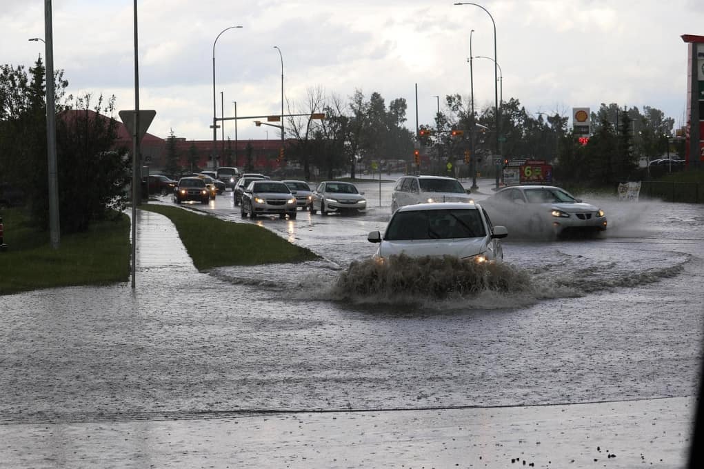
Why Historical Data Is No Longer Enough
One major reason flood risk mapping is changing is that past conditions no longer predict future outcomes as accurately as they once did. Rainfall patterns, storm intensity, and runoff behavior have shifted. Flooding now occurs in places that rarely experienced it before.
Urban development also plays a role. As landscapes become more paved and less absorbent, water moves faster and collects in new areas. Drainage systems designed for older conditions can become overwhelmed.
A short visual explanation can help clarify why relying only on historical flood data no longer reflects current risk patterns.
Advances in Technology and Modeling
Flood mapping has also changed because the tools used to create it have improved. Modern mapping incorporates high-resolution elevation data, satellite imagery, and advanced computer models. These tools provide a more detailed picture of how water moves across land.
Improved modeling allows planners to simulate different scenarios, including heavy rainfall events and infrastructure strain. This results in maps that are more precise but also more dynamic, requiring updates as conditions evolve.
These technological advances make maps more accurate, but they can also reveal risks that were previously underestimated.
What These Changes Mean for Communities and Individuals
Updated flood maps can affect insurance requirements, property values, and construction standards. While these changes may feel inconvenient, they are intended to reduce long-term risk and improve safety.
For individuals, understanding updated maps helps inform preparedness decisions. For communities, it supports better infrastructure planning and emergency response coordination.
Key Takeaways From Changing Flood Maps
Readers benefit from understanding what is driving these updates and how to interpret them.
Key insights include:
Why flood risk can increase even without past flooding
How development affects water flow and accumulation
The role of modern technology in improving accuracy
Why updated maps aim to reduce future losses
How awareness supports better preparedness decisions
These points help replace confusion with context.
Why Flood Risk Mapping Will Continue to Evolve
Flood risk mapping is not a one-time process. As environmental conditions, land use, and technology change, maps must adapt. This ongoing evolution helps ensure that risk assessments remain relevant rather than outdated.
Communities that understand this process are better equipped to plan responsibly and communicate changes clearly to residents.
A short educational video can help explain how flood maps are updated and why revisions are expected over time.
Planning With Awareness Instead of Surprise
Changing flood maps do not mean danger is guaranteed. They mean understanding is improving. When people view updated maps as tools rather than threats, they can make informed choices without unnecessary alarm.
Flood risk mapping reflects a broader shift toward proactive planning. By recognizing how and why these maps change, individuals and communities can approach resilience with clarity and confidence.
When Better Information Leads to Better Preparation
Flood risk mapping across the U.S. is changing because the conditions it measures are changing too. Improved data, evolving landscapes, and better modeling all contribute to a clearer picture of risk. When people understand these updates, they are better positioned to prepare wisely, respond calmly, and support long-term resilience in their communities.
Sources
Federal Emergency Management Agency (FEMA)
National Oceanic and Atmospheric Administration (NOAA)
U.S. Geological Survey (USGS)
National Flood Insurance Program


